Scroll Up

iGlide: the power of simplicity.

iGlide is the gliding moving map app for Apple® iOS® devices, supporting iPhone, and iPad. iGlide offers many functions for beginners, for pilots starting their first steps flying cross country, and for pro pilots in competitions. It is clear, easy to use, and simple.

iGlide Pro is also the first and the only iOS gliding navigation app that provides a full featurset for contest glider pilots flying advanced tasks.
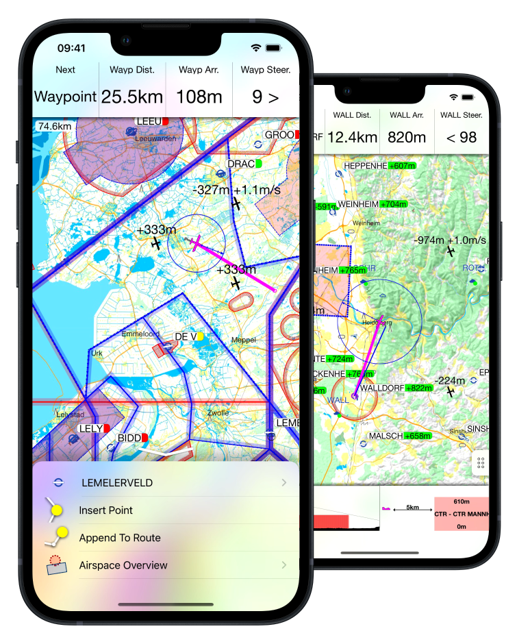
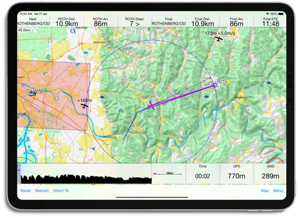
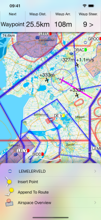
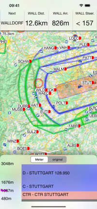
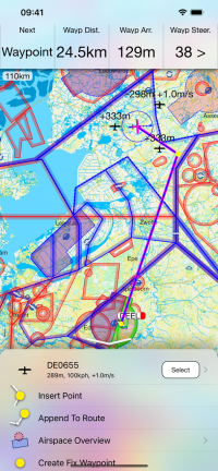
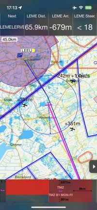
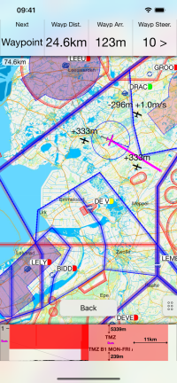
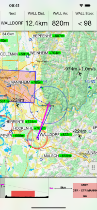
iGlide gives overview, even in highly complicated situations, takes the load off the pilot and gives more time to monitor airspace.


A fresh start.

iGlide, previously owned by AIR Avionics, has been taken over by NaviLogic, and now receives regular updates. Jip van Akker, a fellow glider pilot and founder of NaviLogic, is thrilled work on iGlide, which already made a positive impact in the gliding community. Existing customers can continue to use the iGlide app they purchased.


An edition
for every use case.

iGlide is available in different editions. Lite, Advanced and Pro. Which ever version you choose to start with, you can upgrade at any time without paying the full price again.

iGlide Lite

Features include:
  • Simple and easy to use Direct-To function to a single waypoint.
  • Easy to read, high-resolution terrain map with detailed topographical features.
  • Free daily updates for aviation data such as airspaces, airfields, and navaids.
  • Final glide calculator with Ballast, Bugs, MacCready, and aircraft polar data.
  • Profile view showing terrain and airspace en route.
  • Vertical airspace overview and airspace warnings
  • Free airport and airspace-database with free updates
  • Flight-statistics with logbook
  • Traffic is displayed on the map if an appropriate data source is connected (FLARM, AIR TRAFFIC or similar).
  • Visual and voice traffic warnings, if an appropriate data source is connected.
  • Many display options individually configurable.
  • Flight-logging (IGC and KML format).
  • Live tracking on different servers (livetrack24, skylines, sky-mobile).
  • Track-Line showing the preceding flightpath on the map.
  • Data import for all common data formats (CUP/DAT/OpenAir/PLR etc.)
  • Live METAR weather data for selected airports.
 

iGlide Advanced

All features of iGlide Lite, plus:
  • Route planning over any number of waypoints.
  • Directly upload flight logs to OLC (www.onlinecontest.org) or send via eMail.
  • Rubberband function for quick and easy route manipulation.
  • Accurate wind calculation.

iGlide Pro

All features of iGlide Advanced, plus:
  • Calculation and optimization of the current OLC scoring distance.
  • Extensive route planning with turn areas, assigned areas and implementation of FAI Rules (e.g. finish circle).
  • FAI triangle optimization.
  • Comprehensive in-flight statistics functions.
  • Final glide calculation over terrain.
  • Live and super-easy AAT optimization.
  • Thermal Climb Optimizer.

Get the latest news about iGlide!

Subscribe to the iGlide newsletter to be the first to get notified with updates on the latest versions, development sneak-peaks and discounts.

* indicates required